Search This Blog

Wednesday, December 5, 2012

Blanket... and not of snow!


        I think it was a year ago or a little more, when we cautioned those interested in placer claims to get them now!  We talked about a new gold rush to the Black Hills and the fact that once a company or two figured out that Homestake didn’t get all the gold, lode claims would again blanket the Black Hills like blizzard snow cover.

        So here’s what we’ve heard reported recently… 600 lode claims filed in Pennington County from Rochford to Keystone. Just so there’s better comprehension of that impact, that totals 12,000 acres. We’ve already heard from multiple parties on this that they are overstaking placer claims and private property… the intent to work all that out later.

        So what is the impact to placer mining, you ask?

        Well, existing placer claims are still in place but we caution anyone holding a placer claim in these areas to maintain it!  Paperwork comes due twice a year, with maintenance waiver or fees by the end of August. Affidavit of assessment deadline is approaching Dec. 31. Do not, and we cannot stress this enough, allow any deadlines to pass or you have forfeited your claim. The only choice then is to re-locate, which gives your claim a new location date.

        So where does that leave the greenhorn prospector, looking for their first placer claim?  We get mixed reviews on this… the old placer over lode, lode over placer discussion.  The bottom line is that either way, you have to prove your case in a court of law. The county and BLM are happy to file your location certificate but it comes back to you to prove ownership!

        We’ve spent many, many hours finding placer acreages that were previously blanket claimed by Homestake and became available these past few years. We’ve also got lucky and found some gaps between existing claims. Now we see history repeating itself and we hope these lodes will be developed, because it’s leaving the recreational prospector in the dust as far as available acreage.

Saturday, November 10, 2012

Brr...


        This weekend is confined to home with temps in the low 30s, a bit of snow and wind.

        We’re not really complaining, though, about two days of inclement weather compared to what the rest of the country is experiencing!

        The last several weeks have been spent on a prospecting venture of another sort, but I have had an opportunity on those nicer days to do a little panning, see a little gold.

        Our Iron Creek project progresses and weather may still allow us some mining this year.  The trommel has met safety standards for a small scale operation and Bob is certified as an experienced miner, so things are happening that at least get us closer and closer.

        We’re hearing, indirectly, that a court case has ruled lode claims are allowed over placer, but not vice versa.  We had heard rumblings of this before and it makes sense, to a point. If you have to have discovery, it’s pretty easy to either find gold or not find gold by placer mining. Proving discovery for lode is a lot more difficult, involving sampling, crushing and assaying. The obvious exception would be to find visible gold in ore… an experience we’ve had only a few times through our prospecting ventures!

        What I find really ironic about that is we have a few lode claims with proven gold. Those same lode claims have old dumps, both ore and waste. To process those dumps we would need to file a placer claim, thereby voiding our lode claim? Some things just baffle the mind!

        An apology to all those out there reading… blackhillsgoldmines.com has expired. We hope to get back up and operating, but we’ll keep blogging until that happens!

Friday, October 19, 2012

Guaranteed gold!


I often joke with new prospectors, “Of course I found gold… I always find gold!”

So maybe I’m to blame, but when we steer people the right direction on a good creek and they don’t find gold, they come back to us with, “There’s no gold there.!”

Now with a few exceptions, there’s gold on most of the creeks in the Black Hills.  Common sense tells you that if it is a gold-producing area there is probably gold in the creek.

There’s a lot of “if” in that statement though… If you’re not digging old tailings (easy digging would be the first clue); if someone (or maybe many) hasn’t/haven’t already beat you to it; if it’s been worked and re-flooded (possibility of a little new flood gold)… the list goes on and on.

We remember way back (the good ole days some call them), when our expectations were high and our knowledge low.

Since then we’ve learned a lot.  I posted a graphic photo a few weeks ago about how to dig in old placer workings.  It utilized a \___/ concept for old workings.  Since then I’ve heard from several out there digging it was helpful and they discovered a little gold.

So I’m going to reinforce that with another thought.  Yes, the books and guidelines always preach to run everything.  Personally, I look around and find a spot to “stockpile” the topsoil and subsequent layers until I find what looks to be a gravel layer or clay zone near creek or pit bottom level.  Those top layers may or may not contain small gold, but do you want to see what is really there?  Also it’s a lot easier to fill that hole back in if you don’t find any indication of gold.. just toss it back in after an hour of work instead of laboring for a day running material that doesn’t show any gold!

Several times I’ve been really lucky.  I toss aside the top layers, dig down into gravels a foot or two and test pan out a piece or two of gold! The average scenario, however, is that I find black sands or some indication to “dig deeper!”

That’s what I would term a “guaranteed gold” claim!  It’s not quantities of gold, it’s not nuggets of gold, but I’ll bet I could have started a gold rush from the streets of Deadwood.
 
So a dose of reality to greenhorns.  If you as an inexperienced prospector find gold, it’s probably a really good area and teaches you a great lesson on what to look for!  I well remember days spent digging for a show in a sluice box!  These days I’m still thrilled to find a show in a test pan! That would be when I would start testing the upper layers!
 
Other than that, we're completing some MSHA red tape to get mining and also entertaining another prospecting venture that we'll fill you in on at a later date. We also have found several acres of very locatable creek in two different areas, one a most prominent gold producting area.  Drop us an email if interested at hillshistory1876@gmail.com.


Sunday, September 30, 2012

Whispers of gold...

One questions we get a lot… how to get to what the old-timers found?

I’ve tried to explain this verbally and always seem to fall short. I recently took a photo of an old open cut which will help, I think?

First of all, this placer pit was pushed out with equipment, probably a dozer, sometime in the last 50 or so years. So it was originally a vertical on each side, which I will roughly represent as |____|. As time passed, it eroded to more of a \____/ configuration as shown by my chicken scratching in the photo.

What did they find? We were pretty excited to see, at one end, a pile of river washed gravel! Maybe I should explain that we had hiked up a hill to explore, hoping to find a high bench gravel commonly referred to historically.

The old timers really whispered in our ear on that one, like they had left us a clue to what was in store!

Now how to go about finding what they found at the bottom of the pit? I show an arrow pointing down, indicating that whatever they exposed in the bottom of the cut will give you another clue. Dig down… chances are they exposed bedrock in the bottom of the cut. It’s going to be your call, by sampling and observation, whether they cleaned the bedrock or left you something to represent the ore they exposed. In this instance, chances are they mechanically pushed out the ore and did not manually clean up what was left. Nice of them to leave you that little bonanza, huh?

Cleaned or not, you eventually want to expose the original cut to see the gravel bands that they saw. So now start removing overburden on the floor of the pit toward the original highwall, restoring it to more of a \____|. This exposed highwall will display the gravel bands, allowing you to sample and find out if there was only gold on bedrock or if multiple pay zones exist.

This method works on any old workings, especially manual digging. You can bet those old timers didn’t waste energy digging any deeper than they had to, but by the same token they didn’t stop digging until they ran out of gold!

Bob sometimes jokes about the really old diggings that we encounter, saying “this must have been a left-handed miner!” Have you ever noticed that waste material on those diggings is usually thrown to one side or another? Consistent shoveling is efficient shoveling, so the miner threw material to one side or the other depending on whether he was right- or left-handed!

So whether you believe in ghost miners or not, the “whispers” are there in evidence of what they did and how they did it. Listen… whether it’s with your ear or mental logic!

Mine safety


        We’ve talked about this before, but a sit-down session with Mine Safety and Health Administration (MSHA) brought back into focus some issues that all miners, small or large scale, need to always keep in mind.

        There I go, using one of two words I say you should never use… always and never.  Okay, I used both!

        I guess this is the exception, because we’re talking safety here.  Historically, the newspapers regularly reported accidents occurring at the mines.  Fatalities, obviously, made big news. They also reported, however, loss of vision, smashed feet and hands, and a large variety of head wounds. The details were often gruesome, but here’s one that applies to placer miners and isn’t quite as grizzly:

        Troy, Dakota Territory June 4th, 1877

        Editor Times: -- During the forenoon yesterday, while John Lutz was at work underground, sluicing on claim No. 7, Bobtail Gulch, the earth fell in upon him, completely covering him.  The miners in the immediate vicinity ran to his rescue and succeeded in releasing him after being much bruised and mangled externally, and severely injured internally.  He was carefully conveyed to his cabin where he remained conscious up to about 5 p.m., when he expired.”

            Now I will ask you… how many times have you undercut an exposed wall of gravel, thinking to get that shovelful or two of good ore? Then, when you see multiple flecks or flakes… you take enough more to run a bucket ot two through the sluice.  Pretty soon, you’re flat on your stomach, head and shoulders deep getting just a shovelful or two more!

        Did you notice that dribble of gravel by your left hip? John Lutz probably didn’t notice it either before the rock caved in on him!

        Ignorance can kill… a classic example being when we toured a claim with US Forest Service and Department of Environment and Natural Resources.  They know their stuff, right?  I can tell you which ones knew and which ones didn’t by how close they ventured to a historic shaft on Forest Service property.  Five out of nine surveyed the shaft from a safe distance, three ventured too close for safety, and one grabbed a wire fence straggling from an old rotted post and swung to and fro looking down the shaft!

        Speaking of old mines, we captured this photo of a historic mine and millsite over the weekend. We caution all to avoid entering such workings.  This property is extremely remote and a mine rescue would constitute several hours to just access the location!

        So stop, think and even listen!  If I’m digging and a few pebbles rattle down, I immediately address that potential failure and bring it down in front of me rather than allow it to drop on me!

        Also, you rock hounds out there… when you buy that rock pick you’ve been lusting after, be sure to buy those safety glasses to save your eyes!


        I’ll conclude this with something not always considered a safety risk in the Black Hills… livestock. We took this picture over the weekend after determining that a log fence provided substantial barrier for protection.  Grazing livestock should be respected as much as any wildlife you might find out there.  We’ve seen aggressive cows protecting their calf, and a bull is about as unpredictable as it gets!

        So no loader buckets of gold yet, but we’ll be mining safely when we do get there.


Tuesday, August 28, 2012

What's all the fuss?


        First of all we’ll give you an update on our small scale mining permit.  The US Forest Service signed off on the Plan of Operations for the Iron Creek permit.  We meet with a ranger this week to walk through the site which archaeology has marked out for our disturbance area.

        Everything at the state level (Department of Environment and Natural Resources) is in the works, bond awaiting approval before permit issued.

        We also attended the GPAA Gold and Treasure Show, running into a couple of our prospecting friends there. Alex wanted everything, but we kept our purchases to things we have trouble finding locally. We did see a really nice little 5-gallon bucket buggy that I’m still contemplating… but it can be found here at a local ag-related store that we patronize.

        Now we’ll get back to the “fuss” regarding our small scale permit versus any other small scale permit!

        We have discussed that our mine site falls within the Spearfish Creek watershed.  This fact automatically put us in a position for a hearing before the Board of Minerals. There was also an “intervener” due to this designation, worded that he did not request denial of permit but wanted to make sure the watershed was properly protected.

        So we are first-timers in the permit process, and although we understood the implications of this ruling as setting precedence, we did not know the technicalities required by the hearing for approval.

        The first surprise to us when on-site with the Board of Minerals was that placer mining is an unknown other than that people like to pan gold.  Several members had questions as to how we go about it, what equipment is used, etc.

        So the discussion quickly shifted from emphasis on our project to placer mining in general.  It sure made it all a lot more fun for us, talking about what we love to do!

        The intervener made an attempt to discredit the project with a sweeping gesture from rim to rim of the meadow, telling all that massive flooding had created that drainage and massive flooding can occur at any time.  We’ll get back to this shortly…

        So that was the on-site.

        Now we get to the hearing itself, which is available on audio at SD DENR website.

        The Attorney General staff outlined what needed to be addressed in the hearing.  This gets a little complex…

        The Board of Minerals in previous years negotiated and approved the Spearfish Creek watershed to a preliminary list of unique and scenic properties in South Dakota.  This was based, as far as we can tell, on the fact that Spearfish Creek is able to sustain a trout population.

        The Board, because of our permit, was assigned to determine our four-acre mine site as either removed from the list (or) finally designated as scenic and unique.  This ruling, it was made clear, applied only to that four acres and there were only two option available.

        There was quite a lot of discussion of pre-existing donut holes, something we weren’t aware of.  These occur in the area called the Deadwood Standard project.  Those areas were already permitted at the time of designation to this preliminary list, therefore were left out of the watershed.

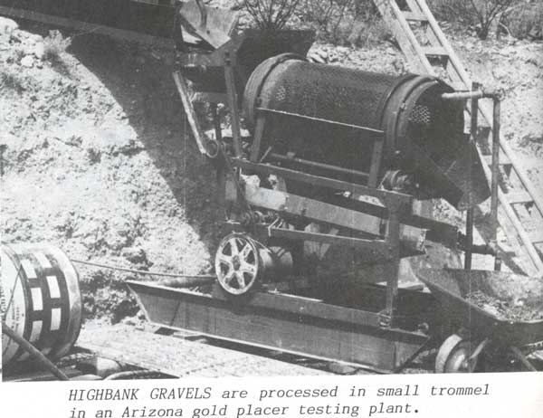
        DENR was next on the agenda, with a gratifyingly complete report on not only our project but geology of the area, hydrology, and a very thorough explanation of placer mining and equipment that we would use in the project.

        So we get to my testimony, which was made blessedly short by the thorough DENR presentation. It was my opportunity to address the intervener’s broad statement regarding historic flooding.  I agreed with how th3 meadow was created historically by flooding, but pointed out that Iron Creek Lake exists just a few thousand feet up the gulch.  Little spring run-off occurs in our mine area.  In fact, our creek flow is primarily dependent on discharge from Iron Creek Lake.  So historic flooding as portrayed, will fill and flood Iron Creek Lake, not our mine site.

        Time for testimony of the intervener, James Nelson.  I recall last week’s Rapid City Journal story about the Lawrence County Commission and the Deadwood Standard project… ½ hour of scenic shots of Spearfish Canyon.  That’s about what we saw and heard also.  It came time for us to ask questions and Bob addressed the impact of 200 homes and septic systems in Spearfish Canyon versus a four-acre mine a couple of miles up Iron Creek.

        It was then the Board of Minerals chance to ask questions and it got a little pointed in that scenic and unique does not define in any way the “McMansions” and septic systems allowed in Spearfish Canyon. These homes are permanent footprints on the Canyon. We were gratified to see this same comment reflected a few days later regarding the Deadwood Standard project.

        So the result of all this is the permit was approved, the four acres designated as scenic and unique but conditions put in place to allow mining.

        If you waded through all that and still don’t understand, drop me an email at hillshistory1876@gmai.com!

        We conclude this with little else to say except that I will attempt to explain in a future blog some of the Deadwood Standard project questions we are getting as to the why and wherefore of events happening.  We’re not involved in that project, but do have a better understanding  of the whole permitting process!

        Support your local miners… we contribute to the local economy and reclaim as we go!


Thursday, August 23, 2012

Pie panning...


We’ve got a story we just have to share!

Some friends of our family missed the opportunity to prospect one of our claims recently, so they picked a day and visited on their own, grabbing a couple of buckets of material to take home.

We did receive a phone call (never underestimate how many people watch for claim jumpers) about a party prospecting. We were happy to learn in the next few days that is was our friends, therefore we have this great story!

These friends have not done a lot of prospecting but had helped dig previously at the site, so they took what they thought were good gravels.

Now let’s talk about beginner’s luck! They didn’t have a gold pan so… they improvised with a pie pan. Pretty innovative, I think!

I’ve lectured that it’s not the pan that you use, but how you pan. This is a stellar example! The first pie pan full of dirt gave them a fingertip sized nugget!

Speaking of prospecting equipment, we’re pleased to see that the GPAA Gold and Treasure Show is at the Rushmore Plaza Civic Center this weekend, Aug. 25-26.

It’s always fun to see what’s out there, but I doubt you’ll see any pie pans there! Do keep in mind though… you can spend a lot of money but you’ll still get the same gold!

We’ll conclude with a brief summary of our permit process. To make a very long story short, the permit site was declared not mineable unless conditions were imposed to ensure the integrity of the watershed. Those conditions… mining outside of the creek, erosion control, protection of creek resources… were all part of our plan from the get-go!

So don’t let politics get in your way… when it comes to permitting, where there’s a will there’s a way!

Friday, August 10, 2012

Public hearing... decision in the near future

        We’re a little nervous, a little excited, but most of all happy to see the light at the end of the tunnel!

        We’re talking small scale placer mining permit. We have a hearing before the South Dakota Board of Minerals on Aug. 15-16 in Deadwood. 

        Wednesday will be an on-site inspection to view the project. We spent a few hours today (Thursday) putting in pin flags to represent the buffer zone written into the permit for Iron Creek, drainage areas that will not be mined, and a general idea of where we will be mining and access to the property.  Whew! Thanks Brian, for all your help.

        We were visited by some very friendly but inquisitive US Forest Service personnel.  We don’t blame them… just doing their job.  Once it was ascertained that we had legitimate reason to be marking out boundaries, that we have a Plan of Operation that allows our activity, and we had no campfires or cigarettes burning, they departed on friendly terms.

        We don’t mind… would rather see them out watching for fire risk than out fighting fire!

        That brings us back to a discussion we’ve had frequently.  We toured the claim with Ms. Hudson of DENR this time last year.  She suffers from allergies.  It was hovering around 100 degrees, there was a slight flow in the creek and numerous wildflowers blooming!

        Flash forward to this year, same time, same place.  The wildflowers and grass are cured, the creek has been dry for at least a month.  It looks and feels more like late September!


        But back to the permit.  I’ve been wrestling with our presentation…  I’ve sat thru so many of these speeches on the other side of the table as a reporter!  What I know is this… keep it short and simple! The Board of Minerals, after touring our little four acre project, go on to tour the Deadwood Standard and Wharf Resources. Thank goodness we’re on the agenda first or they probably wouldn’t even remember us!
        We’re hoping the impression is good and the project sets an example of what really constitutes a small scale operation. It will help in the long run, I think, to distinguish that so many of these permits are really recreational mining (a tiny pit dug with a backhoe to allow user-friendly recreation) from active placer mining with loaders feeding a recovery system.

        That is what we are striving to do… and get some gold while we’re at it! 


Thursday, August 2, 2012

Wanderings....


        A little cooler these days, we’re able to be out and about without total melt-down!  A little rain here and there keeps the workings a bit damp, but at least the undergrowth isn’t snap, crackling under our feet.

Exposed bedrock on privately owned claim, Sand Creek.
        Just a few of the places we’ve been recently include the Tinton area of South Dakota and Wyoming, Castle Creek area, Boulder and Bear Butte creeks and whatever we find of interest in between!

        I’m going to stress something here that we take for granted, but is confusing to many.  We were recently asked where all the homes were at Tinton because people often comment, “Well, we have a cabin at Tinton.”  Locals (maybe a habit acquired from the gold rushers who settled the Black Hills and didn’t want claimjumpers) tend to attach our location to a general geographic landmark.  We say we live at Whitewood.  We actually live a couple of miles out of town, but our address is Whitewood. 

        I try to say “Tinton area” rather than Tinton, but that includes pretty much everything from Iron Creek Lake to Sundance, WY.

        So we stay really busy prospecting areas, helping people locate claims and exploring with various prospectors we meet either through our blog or just traveling from place to place.

        Right now we have some company from Texas;  Randy and Steve try to get to the Black Hills once a year.  They enjoy digging, which is always a plus to us geriatrics!  We give them a few maps and they go dig prospect holes on potential claims!  They also helped me remove some boulders from my current dig, making it possible to keep digging to bedrock.

        Randy and Steve like to take a little gold home, but this year they are also collecting black sand from various areas to test an extraction process.  We’re also trying to help them locate a claim so they can commit themselves to developing a dig on their very own location!  They also visit a few favorite sites in Deadwood, so if they end up with gold and winnings it will be a good trip.

        I forgot to throw the permitting process into the works here.  We will appear before the Board of Minerals this month in the hope of obtaining a small scale placer permit.  We’ve got a whole list of “to do” for an on-site with the US Forest Service and BME.

       One interesting claim search this week involved two conflicting maps regarding private property, three calls to the Bureau of Land Management which resulted in the land office division needing to consult.  A possible claim area, shown as US Forest Service on the Lawrence County GIS site conflicted with BLM Glo as to ownership.  It turns out that it was originally a homestead, then sold to Homestake, which deeded surface rights back to the Forest Service but retained the mineral rights. A big thank you, as always, to BLM staff in sorting out this puzzle!

        As often happens, the mailing from the Bureau of Land Management arrived the day after we posted the last blog.  Everyone who has a claim registered with BLM should get this envelope with maintenance and affidavit forms, plus some information on new rulings being implemented regarding maintenance fees.

        We’re proud to announce that, due to his diligence in researching claims and information we try to get out there through our blog, the Bureau of Land Management has named Bob a “land man” for the Montana-Dakota Bureau.

Friday, July 27, 2012

Small miner waiver....


        It’s that time of year again.  If you have 10 claims or less, you qualify for the Bureau of Land Management Maintenance Fee Waiver Certification Form 3830-2, more commonly called the small miner’s waiver.

         Previous years we have received a mailing that provided at least a draft of this form, but no mailing this year (cost cutting?).  The form, however, is online at the Montana-Dakota BLM site.  We just printed it from there.

         First and foremost… if you qualify for this form it must be postmarked by Aug. 31 or it is invalid.  That will mean sacrificing your claim.  It does not have to be notarized or filed at the county.


         So let’s get to work on this form.  Otherwise, you need to budget $140 for every 20-acre parcel you have claimed!

1.     This small miner waiver is filed for the assessment year beginning Sept. 1, 2012 and ending on Sept. 1, 2013.

2.     The undersigned and all related parties owned 10 or fewer mining claims, mill, or tunnel sites located and maintained on federal lands in the United States of America on Sept. 1, 2012.

3-6 are information items.

7.     The mining claims, mill or tunnel sites for which this waiver from payment of the maintenance fee is requested, are: (Here you fill in claim or site name and BLM serial number [MMC]).

          This form then needs to be signed by all claim owners (extra room on back).  Make a copy for your records and mail the original to BLM for filing by Aug. 31.  No filing fee is needed.

          If you run off the form, instructions are on page 2.

          Additional note:  If you have located a claim prevous to Aug. 31, 2012, you must either include the new claim(s) on your small miner's waiver or pay the $140 maintenance fee.  We got caught on this once and ended up forking out an additional $140 to keep the claim.  I cannot say this with authority, but we believe you do not have to have a MMC to do this, but write pending MMC on the form.

          If you are having trouble finding or printing the form, drop me an email at hillshistory1876@gmail.com and I will email you the form to print.

Saturday, July 14, 2012

Trommels, sluices, riffles


        First off, we want to clarify something we are hearing from a number of people.  Members of the Gold Prospectors of America are telling us that they are limited to hand trowels and pans in the Black Hills.  A direct quote from SD Dept. of Environment and Natural Resources, the state agency that regulates mining in South Dakota, states Recreational mining, such as gold panning and mineral collecting that make use of hand-held equipment such as picks, shovels, gold pans, sluice boxes, or metal detectors is exempt from permit requirements. A mine permit is required for portable dredges or other mechanized equipment, even for use in recreational mining.”

        Secondly, we see a lot of innovative equipment out there.  A lot of what we see is commonly termed, “reinventing the mouse trap” or in this case, reinventing the gold trap!   Our geologist friend was a little puzzled why I use a cheap little black pan for test pans… until he saw me panning in a tiny stream and/or a tub!  That small pan doesn’t need much water, has small built-in riffles and does the trick nicely!  Now with larger amounts of concentrates, for example sluice box clean-up, choose a pan that suits your hand size and has a reasonably large inner circle circumference… allowing swirling!   

        So our conclusion would be… they all probably work, but you don’t have to spend a lot of money!  It’s the same gold, whether the equipment cost hundreds or a few $$.

        On this theme, the third item we will talk about is the tried and true, the basic concept that still works and is simple enough for someone with construction skills to build instead of buy!

        We refer to “How and Where to Pan Gold” by Wayne Winters, originally published in 1961.


        Bob wants you to pay attention to how simple an effective trommel can be!  This is a great example of a little electric trommel simply mounted on skids with one motor running both pump and trommel.  Note the small chute at the top where gravels are dumped and then it appears they are hand-fed.  Discharge is small enough to use only a wheelbarrow, indicating how much is being fed.  The set-up of 4-5 foot cut in the gravel has set this operation up very well for recirculation of water.  Even though there’s 1000’s of holes in the punch plate of the trommel, the discharge chute shows water dripping.  This might be designed to help gravel move down the chute or could be that much water actually retained in the spent gravels.  A simple screen would save those gallons.

         This commercial trommel set up demonstrates a good scenario for riffles in the sluice.  Note that closer to the trommel, riffles become more closely spaced until they are of equal distance.  At the bottom of the sluice, the gaps are for the fine gold to settle and carry water away from the operation.  Hard to imagine any gold getting away!

         Note that sluices are lined with tin, which these days could be easily bought at a lumber yard as flashing.

         A large grizzly is set up behind the main trommel with the only conveyor being a discharge for oversized rock.  The dump truck, seen top left, is vintage but effective with haul road leading to main grizzly.  It looks like a direct dump.

         Simple but effective, the difference between a few hundred dollars and thousands!

          Good news for all interested in our Iron Creek permit... an August hearing is tentatively scheduled and we may get mining yet!

        A final note to check out Black Hills Simple Life Magazine on-line… another editorial effort in my family circle!  We did a short prospecting article this time and there are tons of interesting and informative articles on all aspects of Black Hills living!

Monday, July 2, 2012


First and foremost, Happy Independence Day! All that we love, all that we cherish, is made possible by this great American way of life!

We now digress to a more sober thought… millions are suffering the heat of summer. Power outages contribute to the problem, leaving some metropolitan areas sweltering.

We consider ourselves very lucky. For those of you who have visited the Black Hills, it is rare for the nights to stay hot. About 7 p.m., it starts to cool and many nights you are reaching for jackets in the evening and covers before dawn. Even at Rally time, yet a month away in August, we shiver to see someone riding motorcycle late afternoon into the Hills, hoping they have leather in the saddlebag. A 100 degree day quickly cools to the 50s and 60s, dipping even lower in some of those “icebox canyons” we know so well.

We’ve already had a few of those nights that fail to cool, or like last night we get a late afternoon rain shower and then it warmed back up!

This year the problem is compounded by smoke from forest fires. You hesitate to open windows in the evening when Hills fires dampen because every valley has waves of smoke drifting by.

That thunderstorm that dampens the smoke and dust puts firefighters on alert for the next spark.

Many fireworks shows have been cancelled. The grandkids are all groaning because there will be no fun with bottle rockets, Roman candles…

We’re old enough to remember M*A*S*H the first time around. This past week, it was a sobering thought each morning to hear the Black Hawk helicopters going out each morning to fight the war against fire. Each evening they returned, signaling the end of that day’s fight. The local news filled in details of casualties of the day… acres burned, homes evacuated, percentage of containment.

We’re lucky enough to live in the Northern Hills, where Ponderosa Pine are still predominantly green. That allows us to breathe a little easier, but a recently controlled fire at Crow Peak and a new fire near Newcastle keep the air smoky and all of us adults on constant alert.

So it’s 9 a.m., the a/c is on (sigh) and as we listen to the morning update on Hills’ fires, we schedule our day on what should be an August routine of things to do around home until late afternoon when we can hopefully escape the heat by driving up the gulch to a claim!


Thursday, June 28, 2012

Gold in every pan...

        It’s a legend, right? 

        Well that depends on where you go, what you dig, how experienced you are at recognizing the pay zone!

        A recent experience is worth relating to those skeptics who say, “the gold’s all been mined out of the Black Hills.”

        We have a geologist friend who, in his limited spare time, tags along to check out our current claims and new prospects.  The trip usually includes one of our located claims and one or two new prospects.

        Last weekend we stopped at an old favorite location to do a little metal detecting at the spot where we first found a nugget metal detecting a number of years ago.  Skunked, we found the usual nails, tabs, an interesting looking valve off an antique vehicle.

        We had a quick burger at Rochford, always fun, and then proceeded to one of our claims.  Now here’s where we play the wily old prospector, in that what we found there we’re not really willing to disclose location!  Let it suffice to say it was in the Central Hills and a location we are currently devoting a considerable amount of time to. 

        We drove into the area the day after a decent rain.  We gave the mini-tour and pulled over near what was probably once a holding pond for sluice operations.

        Journeying toward the creekbed, we were pleasantly shocked to see the recent rain had created a little runoff and we actually had some running water… enough for a sluice but while the guys explored I decided to try a pan.

        I hopped across the little stream, used my shovel to kick off grass and take a sample. I shoveled enough depression in the creek to pan. The first pan showed a bit of black sands and some nice garnets.

        The geologist also grabbed a bucket and concentrator and said he’d find a place to dig.

        I kept quiet until I had concentrated half of a 2-1/2 gallon bucket, panned my first pan and there were now two slightly large flecks!  I’ll have to figure a way to save garnets too, though, because they range in color from non-transparent dark to transparent red, orange toned, and pinkish.

        About then, Bob and friend migrated back my way yielding a bucket full of material.

        Bob asked, as always, did you find gold?

        Well yes, I did!  He was surprised, to say the least.  Our friend compared his material to what I was panning and it appeared similar.

        Days later, the geologist gives us a call.  He’s been working in the Hills during the day, then panning the material he brought back in the evening.

        He says he’s quite excited about that claim… he found 3-4 pieces of gold when he panned!

         I can’t stress the importance of experience.  Bob knows that area and where to expect to find gold.  The geologist might be a greenhorn, but he knows what to look for geologically in gold-bearing areas.  The final factor is shallow gravels that hold gold closer to the surface.

        So it’s there, if you look in the right area!

         Note:  We ran into some Michigan gold prospectors headed for Alaska… they got turned around at the Canadian border.  If you’re intent on Alaska gold via Canada, you might want to check requirements for entry into Canada.


Thursday, June 21, 2012

Placers and placer miners...

Alex helps demonstrate the extend of a famous placer...
bedrock cleaned back to still existing gravels.
This is in a withdrawn area... note no shovels or pans,
just a camera!


Some things never change… other things change with each gust of wind.

This couldn’t be more apparent while reading a 1933 “Report of Investigations No. 15” SD State Gological Survey by E.P. Rothrock, state geologist. He says it all in a way I often strive to communicate, and fail!

“The number and wide range of old workings lead to the conclusion that few recognizable surface indications of metal-bearing deposits have been overlooked. However, there are still chances of success for those who, with assured resources, stamina and equipment will study the record of placer mining and choose favorable regions for their prospecting.

“The gold found in placers originally existed in place as deposits of various forms in areas intruded by igneous rocks. In some cases it was deposited in the igneous rock itself in finely disseminated particles; in other cases it was originally in quartz veins, cutting through the igneous and other rocks and formed as a result of the igneous intrusions. Due to disintegrating processes (change of temperature, wind, rain, earth movements and chemical action of running water, and of glaciers in some instances), the gold-bearing rock is transported away from its source. The moving water causes the heavier gold particles to work slowly toward the bottom of the stream bed. On reaching bedrock, or hard pan, the gold moves slowly downstream until it lodges in crevices, cracks or other irregular openings in the stream bed.”

Anyway, this is a reader-friendly report and email me if you want the entire report or just search for it on the net. What I want to relay to you is the following information on the different types of placers. I hope it will help explain why superficial panning from the creek is usually fruitless or bears little gold.

Residual placers: “These are placers in which the gold is accumulated in placers by disintegration of the rock containing it. It is not transported from its original source.”

Hillside placers: “These are very old deposits, occurring on the tops and sides of hills. They may have been left in this elevated position because of earth disturbances which lifted the area above the former stream, or the original stream which deposited them may have changed its course or have meandered to a new bed. These deposits are intermediate between the creek and bench placers. Their bedrock shows no indication of benching.”

Creek placers: “The creek placers are gravel deposits in the beds and intermediate flood plains of small streams. These placers from which most of the gold has been taken constitute the best-known type of deposit. Brooks described this form of placer as follows: ’The pay streak in these deposits is usually on bedrock though it sometimes is found on a clay which overrides the bedrock. Where no clay is present the gold is found not only on the bedrock, but also where the rock is broken, the gold has worked its way down into the joints and crevices. Streams are often found to have a layer of clay on bedrock, which gradually thins out upstream and finally disappears entirely. The presence of the clay on the bedrock usually indicates that no gold will be found in the weathered rock below, as the impervious layers prevent the gold from working its way down.’”

Gulch placers: “These are very similar to creek placers, except that there is now little, if any, flowing water present.”

Bench or terrace placers: “These are more or less ancient placers, occurring in bench or terrace form, on the sides of valleys or courses of ancient streams from 50 to 300 feet or more above the present stream level. The presence of well rounded gravel is indicative of material carried and sorted by water.

Change, as we mentioned before, has been in the legal system. When this report was written in 1933, there was no state regulation of South Dakota minerals. That’s a whole lot different these days!

We conclude this blog with an oft-repeated phrase of “practice, practice, practice!” We tell newbie-prospectors this about panning, prospecting… everything!

“Technical or scientific education, although it would be helpful, is not necessary for the prospector. However highly he is educated, he has to learn by experience. He cannot, by reading books, set forth into the mountains a full-fledged prospector. A prospector, however, must have ‘courage, natural resourcefulness, good powers of observation, but most of all, tireless patience and physical energy. A new mine is not likely to be found on a summer’s holiday or a casual vacation.”

While we’re on the subject of efficient prospecting, we researched for the heck of it the Sunset Valley Mining Co. claims called the Mystics. There exists, in this section, 40 acres of ground open for mineral entry. The rest is withdrawn or private. These 40 acres, as far as we can tell from record, have been staked since 2008. Sunset Valley staked probably 80+ acres in this area. That puts 40 acres over the top of another claimholder and 40+ in a withdrawn area! Kindof hard to win in a case like this! Bob says, “That’s a mighty expensive piece of paper!”

Monday, June 11, 2012

Panning and sluicing


        Our most often read articles deal with two topics… panning and sluicing.  It makes sense, since not only are they the most commonly used methods of recovery, they are entry level “gotta have” kind of skills.

        Struggling with sluice box setup is common.  That’s why we look for an area that has not only good gold potential but a relatively easy sluicing setup. 

        Ideally, there’s sufficient drop for the 1 to 1-1/2 inch per foot of sluice box recommended and still have an additional inch or two for a rock under the bottom end of sluice.  That allows a little room for the tailings to drop out and wash away.  Eventually you’ll be cleaning out tailings with a shovel without disturbing the sluice flow. 

        A small rock dam can be built to obtain drop.  This works well in narrow streams but in a wide stream it does not need to be built the entire width, just enough to create sufficient flow to the sluice box.

        The top flare (if you have one) can nestle between two decent-sized rocks to secure the sluice in place.

        At this point, you can either dam water and seal with tailings ahead of the flare or allow free flow around the sluice, depending on the flow.  Too little water allows the sluice to clog and needs constant tending.  Too much flow carries everything right out the end!  Ideally, you have a nice ripple effect over the riffles.

        What do see most often in sluices and highbankers (permit required)?  Too much water too fast... dial it down!  If you doubt the flow, test the tailings directly off the end of the sluice.  I'll bet I could "cleanup" off the tailings and catch pans on just about every operation running in the Hills!

        So you’ve set up the sluice… throw a scoop or small shovelful (depending on size of sluice) of material in and watch how it flows through the box.  Level the sluice side to side if material doesn’t flow consistently by adding minor height on the low side.

        Now you have established a sluicing point and can add stepping stones, level a convenient bucket location, trim branches out of the way… all those things that make a house a home!

        Shovel away and enjoy the day.  But all that doesn’t mean much if you end the day by losing your gold!

        As critical as sluice box setup is cleanup.  You need to break the flow of the creek by lifting the flare end of the sluice first.  You can then proceed with cleanup.  If you do not lift the flare end first, it’s easy to dump what was in the flare right back into the creek or disturb the riffles where your gold is probably resting.

        Remove rib matting and/or carpet; clean thoroughly in a 5-gallon bucket; remove matting and/or carpet. Place the bottom end of the sluice into the 5-gallon bucket and flush concentrates with several pans of water.  Directions on this vary according to model of sluice, so we’ll keep it general! You can then transfer concentrates back to the pan for final panning.  A good hint… splashing water into an inverted bucket cleans it out quickly.

        We’ve watched a lot a people pan… we’ve panned a lot of material… DO NOT RUSH THIS PROCESS!  Remember, these concentrates are mostly heavy materials that have dropped out with gold.  Gold “riding up” with these materials is common.  Critical to the process is shaking down materials frequently and using a smooth, fluid circular motion.  

        My parents taught me if it’s worth doing, it’s worth doing right.  In the case of gold panning quality merits quantity and speed equals loss instead of gain.  Use a catch pan… it’s the only way to learn what you’re losing.

        This isn’t speed panning… leave that to the competitors.  Speed panning consists of a defined number of consistently-sized nugget-like pieces.  Your concentrates may include flour, flakes and hopefully nuggets.  I’ll just about bet it also contains black sands of some sort, nodules, bits of quartz, possibly some lead shot in hunting areas, a rusted nail or two.  You need to pay attention to the contents of the pan.

        One final word of advice… if you are encountering a lot of black sands, clean the sluice box more often or split up the concentrates to pan.  I’ve had pans of concentrates handed to me that almost dropped me to my knees (okay, I’m a lightweight!).  If you can’t comfortably handle the size of the pan or the quantity of material, grab a pan that suits you and break it into a couple of sessions.

Location, amendment and relocation

Not much entertainment here... but two blogs being posted!  So if you're not wanting to delve into this process, check out most recent panning and sluicing blog.

The location process… finding a claim is complicated enough as we’ve stated time and again. We’ve talked about the process multiple times.

So the procedure hasn’t changed much, but how many know that when you go to locate a claim there are federal regulations based on the 1872 mining law supplemented by individual state requirements?

So let’s review the federal regulations… this is going to get a little tedious unless you are specifically interested in the subject.

The Bureau of Land Management regulates mineral claims on the federal level. The Montana Dakota office in Billings, MT is in charge of the Black Hills. They state on their webpage:

STAKING A CLAIM--Federal law specifies that claim boundaries must be distinctly and clearly marked to be readily identifiable. Most states have statutes and regulations concerning the actual staking and recording of mining claims so claimants should refer to the appropriate state agency for additional requirements before locating a claim.

Prior to locating a claim, a prospector should check BLM records for prior recorded claims. Ultimately, the prospector must check for prior existing claim markings on the ground. Departmental decisions require a discovery on each claim, based on actual physical exposure of the valuable mineral within the claim boundaries. (Also, each 10 acres on a placer claim, after a discovery, must be mineral in character).

1. Claim boundaries must be distinctly and clearly marked to be readily identifiable:
We agree, but it just isn’t so! Some marks are completely outdated; others just plain don’t exist… therefore the next step is critical.

2. A prospector should check BLM records:

3. Discovery on each claim

Filing a claim, according to BLM, is as follows:

RECORDING A MINING CLAIM--Claims and sites must be recorded with both the state and the proper
BLM state office (state laws usually require filing the original location notice or certificate in the proper county office).

The Certificate of Location (COL) or notice must be filed with BLM within 90 calendar days after the date of location. Check with the proper county for their filing requirements.

A location map is required by BLM to accurately determine location and land status of the claim.

You have 60 days to file with the county in which you located in South Dakota.

BLM requires a copy of the official record of the notice or COL of each claim that was or will be filed under state law. (BLM does not require the original document, nor does the document have to be notarized.)

Do not send BLM your COL filed by the county and returned to you. Send a copy.

BLM does not require the claim information to be on any specific form, nor does BLM produce/distribute a form for such purpose. Local printing companies or stationery stores are typical sources of forms. The form submitted to BLM should include the date of location, the name and address of the owner(s), the name of the claim/site, the type of claim/site, the acreage claimed, and a description of the parcel on the ground (township, range, section, quarter section, and/or a metes and bounds description).

Be careful of pre-printed forms… we’ve ran across one or two that do not meet state requirements, one of which is distributed by a county office.

Pretty easy so far, right? We would estimate that only about 10% of those staking a claim go any further than this information. Grab a blank claim form or work from a copy of an existing form, file it and start panning!

Wait just a minute… did it say boundaries must be clearly marked? What about all the additional requirements for the appropriate state?

So we venture to South Dakota Codified Law (which we feel a little intimate with through the permitting process). Note that these laws use the word lode, but are considered by the state as guidelines for placer locations as well. It’s another technicality that we don’t want to dive into right now because it is not relevant to this discussion.

SDCL 45-4-2. Conditions precedent to filing of location certificate. Before filing a location certificate pursuant to § 45-4-4, the discoverer shall locate the claim:

(1) By erecting a monument at the place of discovery and posting on the monument a plain sign or notice containing the name of the lode, the name of any locator, the date of discovery, the number of feet claimed in length on either side of the discovery, and the number of feet in width claimed on each side of the lode; and

(2) By marking the surface boundaries of the claim.

Marking the claim is further clarified:

SDCL 45-4-3. Marking surface boundaries of claim. Surface boundaries shall be marked by eight substantial posts, hewed or blazed on the side or sides facing the claim and plainly marked with the name of the lode and the corner, end, or side of the claim that they respectively represent and sunk in the ground; one at each corner and one at the center of each side line and one at each end of the lode. If it is impracticable because of rock or precipitous ground to sink such posts, they may be placed in a monument of stone.

Most often noted error on this level… lack of posts on the ground and on the required map. Eight posts, not four, not six. Here is where the county distributed COL lacks direction, prompting for too few posts. “Substantial” is a word that leaves a lot of room for interpretation, but we do know that the US Forest Service (another agency!!!) does not like PVC pipe, steel posts and in this age of the pine bark beetle, does not want you blazing trees!

And the location certificate, as required by state law:

45-4-4. Location certificate--Recording of claim--Contents--Validity. The discoverer of a lode shall within sixty days from the date of discovery record the claim in the office of the register of deeds of the county in which the lode is located by a location certificate which shall contain:

(1) The name of the lode;

(2) The name of the locator or locators;

(3) The date of location;

(4) If a lode claim, the number of linear feet in length claimed along the course of the vein each way from the point of discovery, with the width claimed on each side of the center of the vein; the general course of the vein or lode as near as may be; and a description of the claim located by reference to some natural object or permanent monument as will identify the claim.

Any location certificate of a lode claim that does not contain the information specified in this section is void.


If, in the interest of discussion, these guidelines were taken to a court of law a large number of existing claims would be overturned. Good faith counts for a lot and the cost of contesting a claim in court is prohibitive, so that doesn’t happen all that much.


The next two items contribute to a lot of discussion at our home… amend or relocate. It’s a discussion we’ve covered in our blog repeatedly, in that an amendment preserves the original location date whereas relocation is just the same as a new location in the same place as your old location. There are few advantages to a relocation, but is a valuable tool if you have inadvertently neglected to file annual paperwork and want to retain the claim.

Feeling pretty secure in the validity of your claim? Here’s a slap in the face which we’ve seen before and we are keeping an eye on right now. Thorough research at the county (therefore state) level and at BLM in October 2011 showed a section with no claims in the area of interest. No valid paperwork or boundary markers existed on the ground. Claim staked, claim filed. Several months later (spring) an amended location certificate shows up on the ground. The amendment shows that a claim from another section staked in January 2011 is being amended to same ground covered by November claim. There are a multitude of possibilities how this may wash out. In this particular situation, we feel it’s only a matter of time until the situation fades into distant history. However, in general if there are not other problems, the amended claim would take precedence and eliminate the rights of the claim staked in November.

We consult BLM to address amending a claim:

AMENDMENTS--An amendment (1) may or may not take in different or additional unappropriated ground; (2) may correct or clarify defects or omissions in the original notice or Certificate of Location; (3) may change the legal land description; (4) may change the claim name; and (4) may change the position of discovery or boundary monuments (under Montana State law, the point of discovery cannot be moved). Amendments cannot be used to transfer ownership of a mining claim.

That’s about as ambiguous as it gets… may or may not! The guidelines are a little more clear cut, according to BLM officials, in that you can reduce the size of the claim but not take in additional acreage. We find no state statutes addressing an amendment.

RELOCATIONS--A relocation is treated much the same as a new location which essentially covers the same land as a prior mining claim/site. As such, a relocation will be issued a new serial number and date stamp.

A relocation does not relate back to the date of the prior location and is adverse to the prior location.

A relocation may not be established by the use of an "amended location notice," but requires a new, original notice or certificate as prescribed by state law.

So if you consider yourself a law-abiding citizen, look at the federal law, then look at the state statutes. Under most situations you can consider the federal law as a starting point, then go to state law for further clarification… mining or not that’s the way it works.